>>>臨海觀測站>
● Provide a platform for long-term monitoring of the background of coastal ocean environments.
● Serve as a permanent base from which the fundamental studies for physical and biogeochemical processes of the site, and adjacent coastal waters can be made.
● Provide with field experience and data which complement laboratory and analytical studies and provide a better understanding of the influence of field conditions on engineering measures and design practices.
● Provide a test bed for evaluating new instrumentations, remote sensing technologies and numerical models.
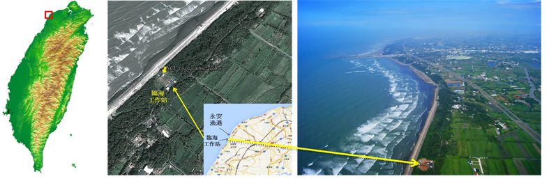
經度緯度:24.966083N,121.008584E;
地理描述:桃園市新屋區蚵殼海岸(永安漁港南側綠色隧道內),距中央大學20公里;
佔地面積:1510 平方公尺;
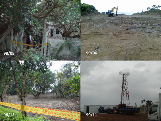
● 本土地原海巡署北部巡防局管理之閒置營區。
● 98年8月由桃園縣政府無償借用中央大學使用。
● 98年12月原使用單位拆除地上建物,以素地歸還桃園縣政府。
● 99年2月桃園縣政府同意無償撥用中央大學管理與使用,使用目的:海洋觀測與研究。
● 99年6月發包進行整地與臨時辦公場所建置工程, 9月20日驗收。12月水電、寬頻網路接管完成。
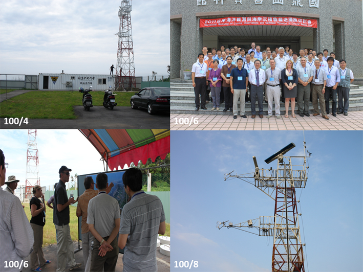
● 100年3月通量觀測系統建置完成,開始觀測基本氣象要素、海氣交界水氣、CO2、熱量、動量通量。
● 100年6月海象微波遙測系統建置完成,開始觀測波浪、海流、海岸線變化。
● 100第一季~ 開始定期底碇ADCP陣列波浪、海流剖面,海溫觀測。
● 100年7月大氣溴化物監測系統建置,開始觀測。
● 101年9月 座標與水準引測,控制點鋼樁埋設。
● 101年12月濱海及潮間帶地下水井陣列建置完成。
海岸地區大氣邊界層(Marine Boundary Layer in Coastal Zone):二氧化碳、動量、熱量通量,摩擦速度、海表粗糙度;
波浪、海流與近岸水動力(Nearshore Hydrodynamics):海面波浪場、海面流場及碎波帶特性等;
海岸沉積物輸送(Coastal Sediment Transport):海岸侵蝕、海域懸浮沉積物特性;
水文與流剖面(Oceanic Hydrology):生地化因子及水質,包括海水溫度、鹽度、pH、溶氧量、葉綠素等,流速剖面;
大氣污染物(Atmospheric Pollutants):三溴甲烷Bromoform、二溴甲烷Dibromethane等;
海岸地下水(Groundwater in Coastal Zone)
電離層放電(Ionosphere Lightning)